Improving Land Information Accuracy!


Improving the accuracy of land information!
Related to the KRAS continuous thematic map maintenance project based on continuous cadastral maps
We have compiled answers to questions that citizens have been curious about!
Before we dive into the details
What is a continuous cadastral map, and what is a continuous thematic map?
What are continuous cadastral maps and continuous thematic maps?
A "continuous cadastral map" is
a continuous representation of map information created by connecting boundary points on a computerized cadastral and forest map without conducting a survey!
It is characterized as a reference data that is difficult to use as survey data!
Based on this continuous cadastral map, the spatial information (thematic map) constructed by local governments is called a "continuous thematic map"!
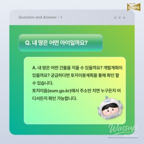
❓ What kind of land do I have? ❓
❗ What kind of buildings can I construct on my land? Are there any development plans? If you're curious, you can check through the land use plan.
You can check it anytime, anywhere by simply entering your address on LandEum (eum.go.kr). ❗
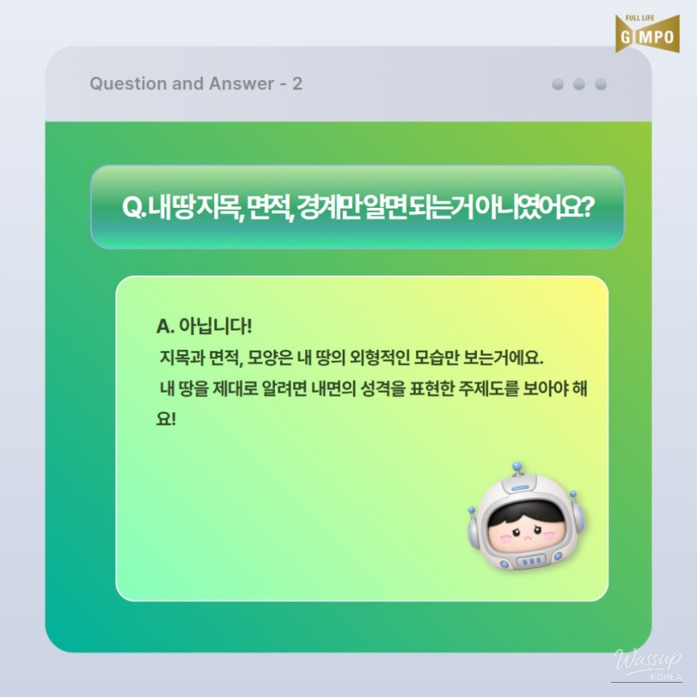
❓ Isn’t it enough to know the land category, area, and boundaries? ❓
❗ No! The category, area, and shape only represent the external appearance of your land.
To truly understand your land, you need to look at the thematic map that expresses its inner characteristics! ❗
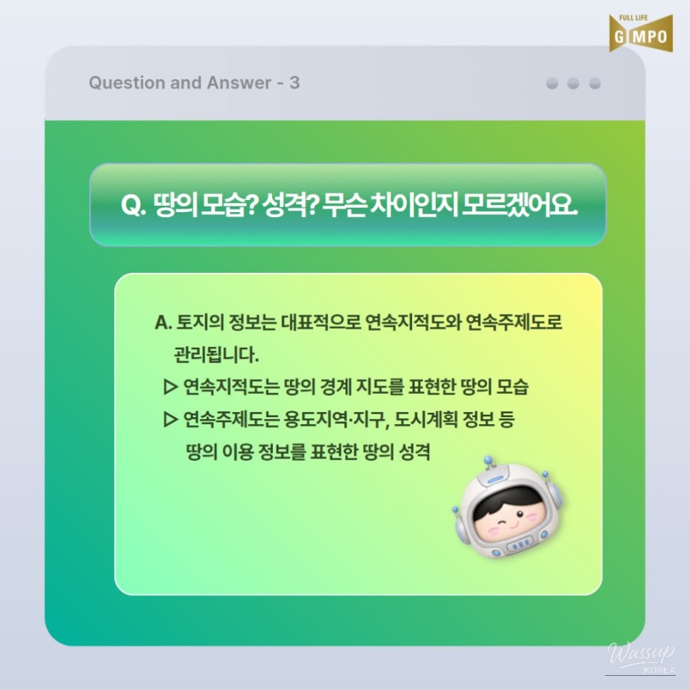
❓ The appearance of the land? Characteristics? What’s the difference? ❓
❗ A. Land information is primarily managed through continuous cadastral maps and continuous thematic maps.
✅ Continuous cadastral maps represent the physical appearance of the land's boundary
✅ Continuous thematic maps express the characteristics of the land, such as zoning, districts, and urban planning information! ❗
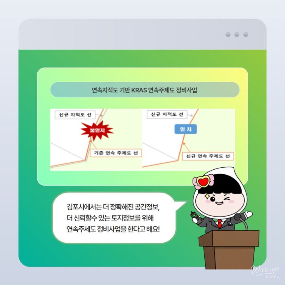
In Gimpo City, you can expect more accurate spatial information and more reliable land information!
[Continuous Thematic Map Maintenance Project based on Continuous Cadastral Maps (Urban Planning Department)]
In all areas of Gimpo City, to prepare for delays or errors in permits and disputes over real estate boundaries and areas,
the continuous thematic map maintenance project is being promoted.


Source :https://blog.naver.com/gimpo2010/224307617734
No comments yet.