A Journey to Woraksan Mountain and Haneuljae Pass in Autumn


The anticipation for autumn's arrival outweighs the desire for summer's heat to end.
The mountains and rivers, once clad in green, transform into a vibrant tapestry of colorful hues.
Valleys embracing the autumn sunlight warmly welcome visitors who have eagerly awaited the season.
A sudden drop in temperature and news of the first snowfall prompted a hurried trip to Woraksan Mountain to embrace autumn.
Woraksan National Park, named for the moon appearing to hang from its peaks, was designated as Korea's 17th national park in 1984, covering an area of 287.571 square kilometers.
It is situated in the middle of the Baekdu-daegan Mountain Range, connecting Sobaeksan Mountain to Songnisan Mountain.
Woraksan Mountain is known for its towering cliffs and rugged terrain, and its main peak, called Yeongbong, has long been regarded as a sacred mountain.
As one of Korea's five most rugged mountains, Woraksan is centered around its highest peak, Worak Yeongbong [1,094m], with a ridge extending south towards Mansubong [983.2m] and Poamsan Mountain, resembling sharp shark teeth.
It encompasses over 22 large and small mountains and peaks, including Mansubong, Geumsusan, Sinseonbong, and Doraksan.
Bordering Jecheon City, Danyang County, Chungju City in Chungcheongbuk-do, and Mungyeong City in Gyeongsangbuk-do, Woraksan is easily accessible from the Seoul metropolitan area and offers scenic views in harmony with Chungju Lake, making it a popular destination for visitors year-round.
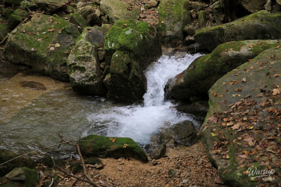
Additionally, Mansu Valley and Songgye Valley, formed by the streams flowing down from Woraksan Mountain, have well-maintained trails perfect for leisurely walks.
Woraksan is home to Haneuljae Pass, Korea's first mountain pass connecting Mireuk-ri in Suanbo-myeon, Chungju, to Gwaneum-ri in Mungyeong City.
Designated as National Scenic Site No. 49, Haneuljae Pass stands at a modest 525m above sea level, but there's a reason it's called 'Haneul' (sky).
Under the clear sky, Haneuljae Pass, with its refreshing breeze, appears to touch the heavens, hence its name.
Haneuljae Pass, formerly known as Gyelipnyeong, was pioneered by King Adalla of Silla in 156 AD for his northward advance.
King Gongmin of Goryeo, as well as Prince Maeui and Princess Deokju of Silla, also traversed Haneuljae Pass.
Holding two thousand years of history, Haneuljae Pass served as a route for the spread of Buddhism and a path filled with the joys and sorrows of peddlers and commoners.
Mireuk-ri in Suanbo-myeon, where Haneuljae Pass begins, is said to represent the 'afterlife,' while Gwaneum-ri in Mungyeong City symbolizes the 'present life.'
Thus, beyond being a physical path crossing the Baekdu-daegan Mountain Range between the Han River and the Nakdong River, it also carries the spiritual significance of a crossroads between the present and the afterlife.
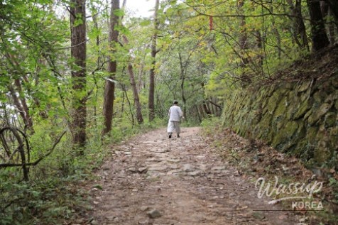
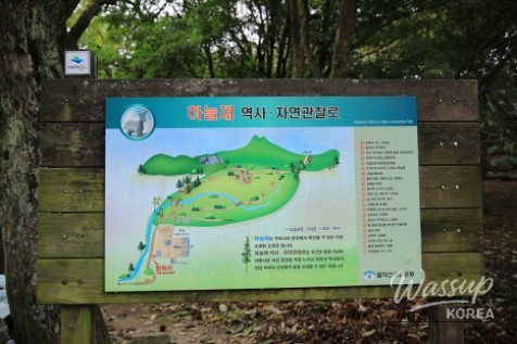
To fully experience the autumn of Haneuljae Pass, take the trail from Mireuk-ri in Suanbo-myeon to the summit of Haneuljae Pass.
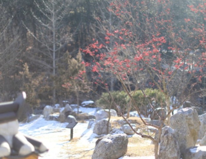
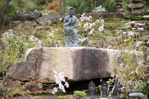
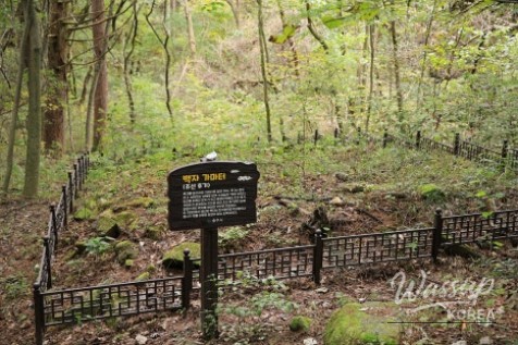
In Mireuk-ri, Suanbo-myeon, lies the Mireukri Temple Site, the site of an early Goryeo Dynasty cave temple.
Although long known as an abandoned temple site, remnants of the ancient cave temple remain intact, including the Standing Stone Buddha (Treasure No. 96), the Five-Story Stone Pagoda (Treasure No. 95), the Three-Story Stone Pagoda, and a stone lantern.
The Standing Stone Buddha, facing north as if to face the Maae Buddha statue in Deokjugol Valley, is a place where people continuously offer prayers.
The Haneuljae Information Center, which opened on August 1, 2024, aims to enhance the historical and cultural value of Haneuljae Pass and expand cultural and tourism content in conjunction with the trails.
Chungju City has established the Chungju Information Center at the starting point of Haneuljae Pass, while Mungyeong City has created the Mungyeong Information Center.
Chungju City and Mungyeong City have been promoting the Haneuljae tourism revitalization project since 2020.
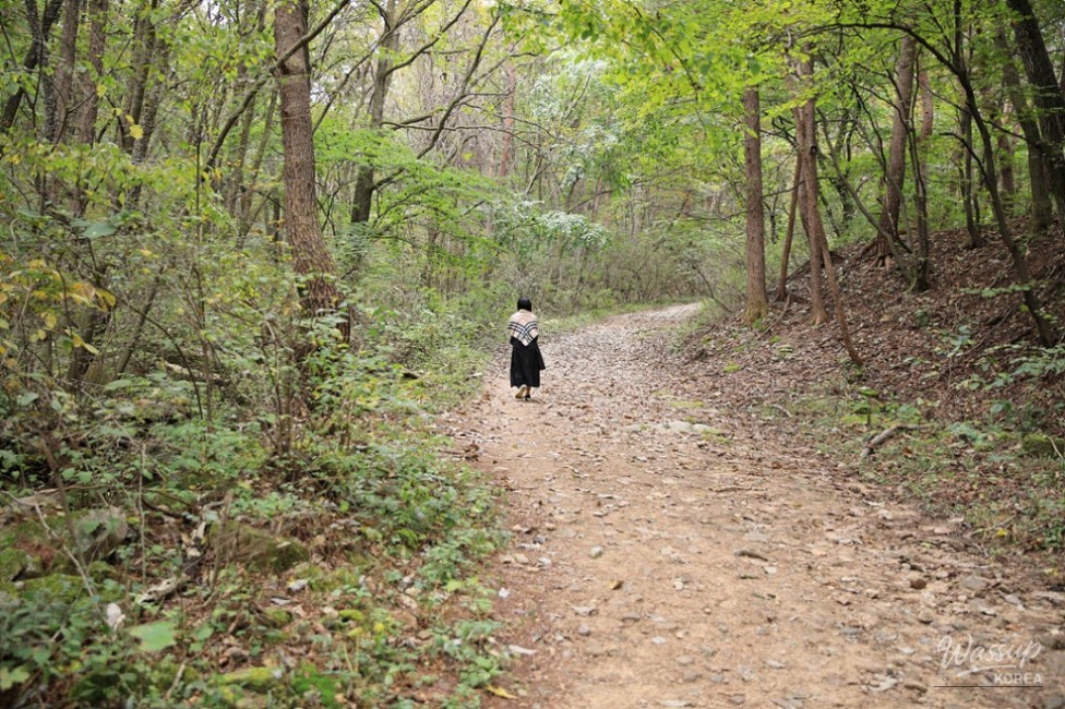
The trail to the summit of Haneuljae Pass is approximately 1.8km long and takes about 3 hours round trip.
Haneuljae Pass is beautiful in all four seasons, with azaleas in spring, clusters of Korean lilies in summer, autumn foliage, and snow flowers in winter.
Uniquely shaped trees, such as the Yuna-resembling tree and the Yeonri-mok (Siamese tree), add to the fun of walking through the forest.
The path up to Haneuljae Pass is a hiking trail that anyone, young or old, can easily walk.
The national park has created a well-maintained path for a comfortable ascent.
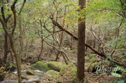
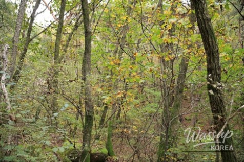
You can enjoy nature and the forest along the gentle hiking trail, listening to the clear water flowing from the valley and the chirping of birds.
Although the leaves have not yet turned, the forest is still beautiful.
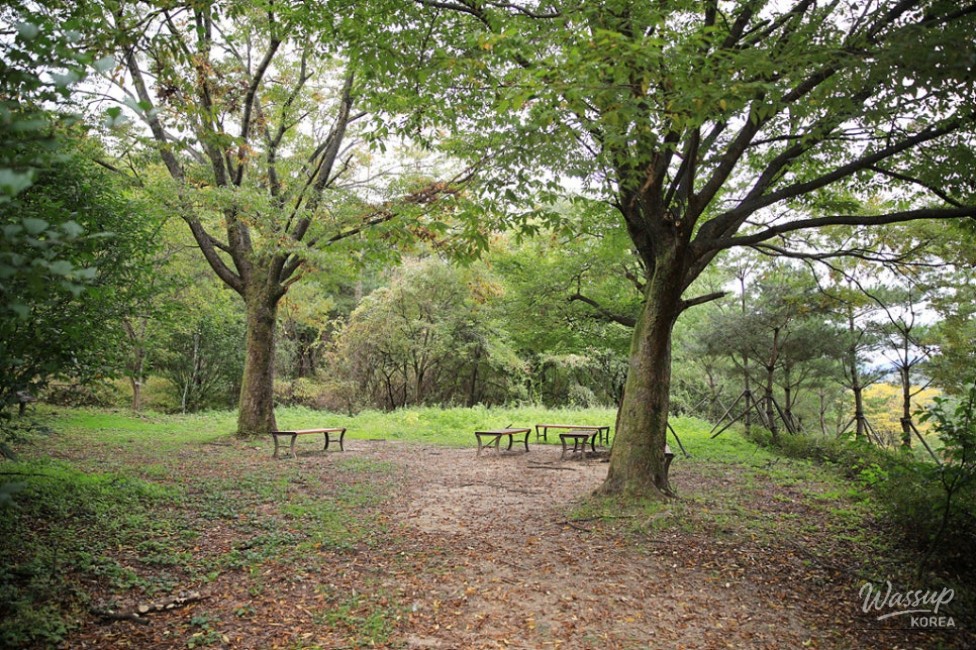
About 40 minutes from the entrance of Haneuljae Pass, you'll see the summit of Haneuljae Pass.
You'll know you've reached the summit when you see the sign at the Haneuljae Pass Park Ranger Station.
The trail from Suanbo leads to Haneuljae Pass, while Mungyeong City has a road leading directly to the entrance of Haneuljae Pass, allowing you to visit Haneuljae Park.
At the summit of Haneuljae Pass, hiking trails connect to Poamsan Mountain and Mapae Peak, and there is also a small park for resting.
There is a monument marking Haneuljae Pass on the Baekdu-daegan Mountain Range, as well as a Sanshingak (mountain spirit shrine).
There is also a small shop in the Haneuljae Pass parking lot in Mungyeong City where you can get a quick bite to eat.
Although it may be a bit early for autumn at Haneuljae Pass, the highest pass under the sky, the time spent walking while listening to the cool breeze, clear water, and fresh birdsong is the best gift.


Source :https://blog.naver.com/cbkb21/224056160818
No comments yet.