Cheontaesan Mountain: A Thrilling Hike Through Granite Peaks and Ancient History
400, Nugyo-ri, Yangsan-myeon, Yeongdong-gun, Chungcheongbuk-do, South Korea
천태산


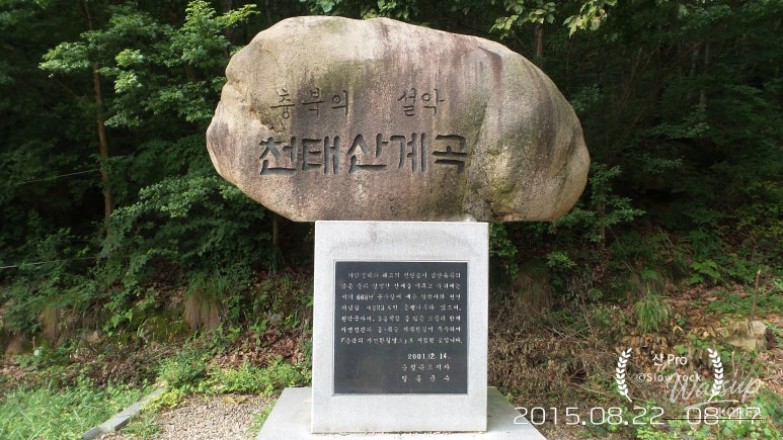
Cheontaesan Mountain (천태산), standing at 715m, is widely celebrated as the "Seoraksan of Chungbuk." Located on the border of Yeongdong and Geumsan, this mountain is famous for its stunning granite ridges, clear valley waters, and the historic Yeongguksa Temple. It is a must-visit destination listed among Korea's 100 Famous Mountains.
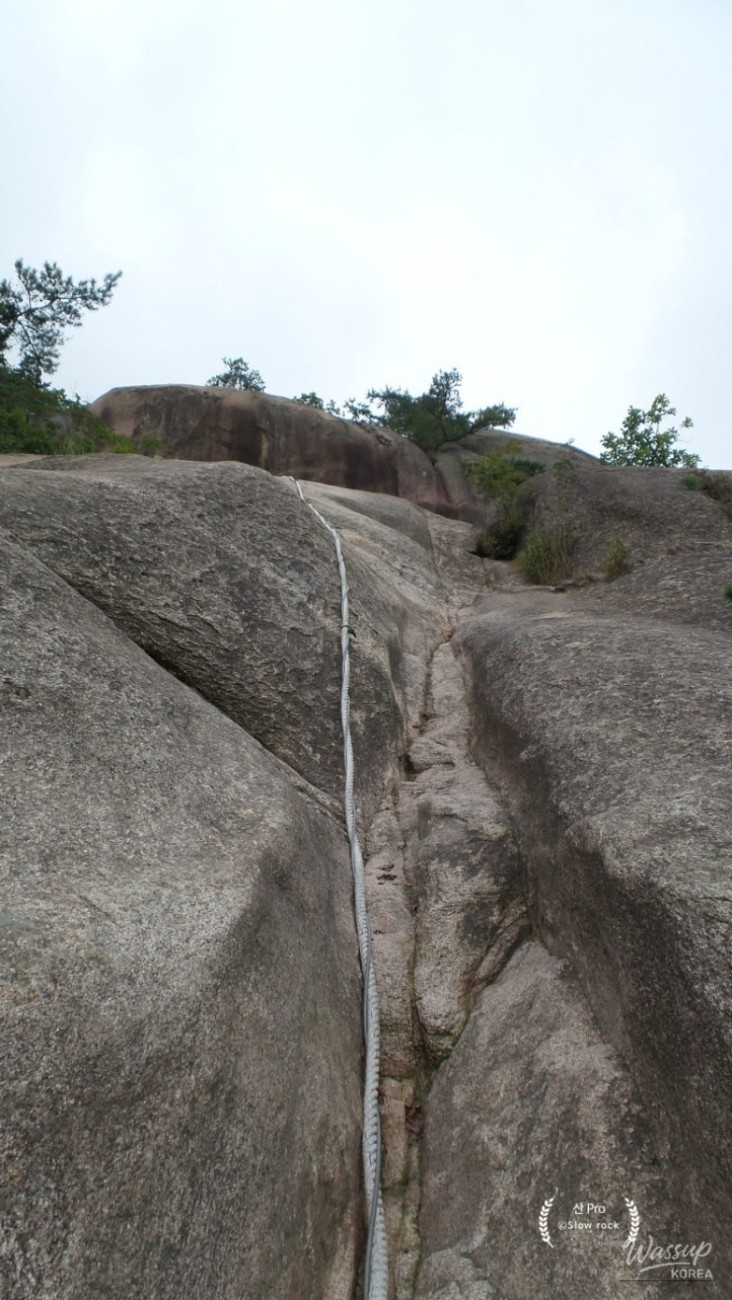
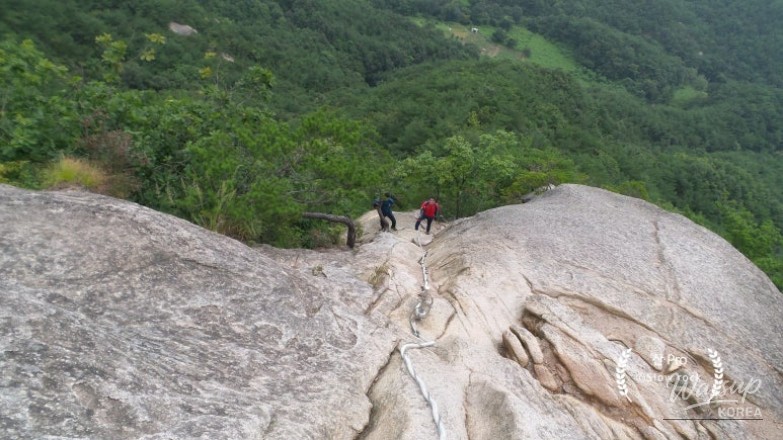
The true highlight of this hike is the exhilarating rock climbing experience, featuring a vertiginous 75m rope section that challenges even experienced hikers. Beyond the thrill of the ridges, the mountain is home to ancient cultural relics and a legendary 1,000-year-old ginkgo tree, making it a perfect blend of adventure and history.
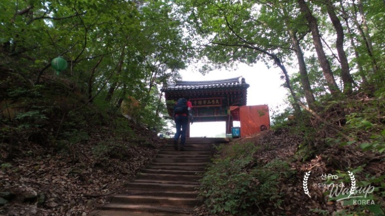
The Gateway to Adventure: Yeongguksa Temple
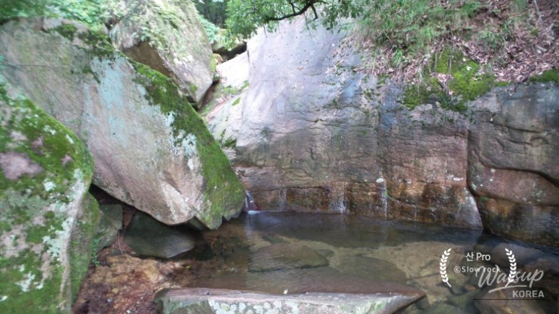
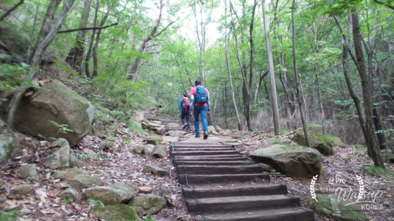
The journey begins at the Yeongguksa Temple parking lot, where the sound of flowing water from Cheontae Dongcheon welcomes hikers. As you walk toward the temple, you pass the serene Jinju Falls and the impressive Samdan Falls. This entrance area sets a peaceful tone before the rugged ascent begins.
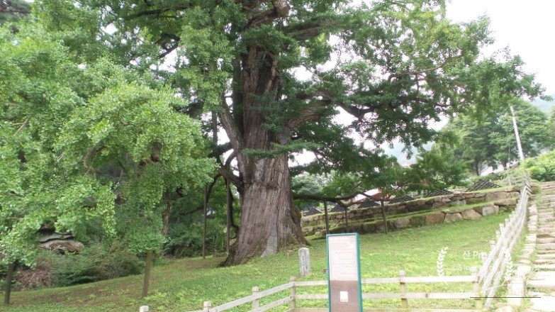
One cannot pass Yeongguksa Temple without admiring its guardian: a massive ginkgo tree that has stood for over a millennium. Standing 31m tall, its unique branches take root in the ground, creating a mystical atmosphere. From this point, the hiking trails diverge, leading travelers toward the rocky heart of the mountain.
Hiking Overview and Course Details
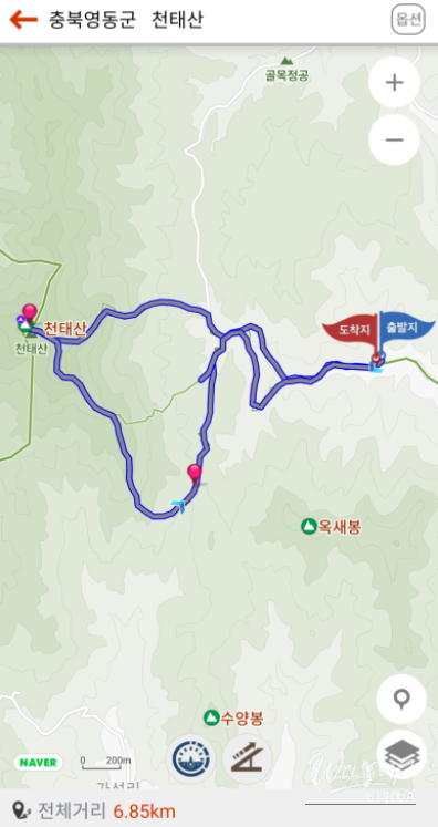
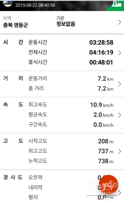
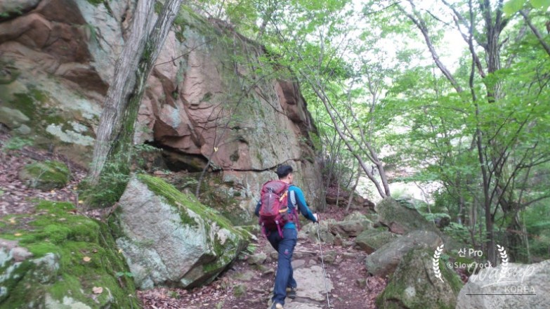
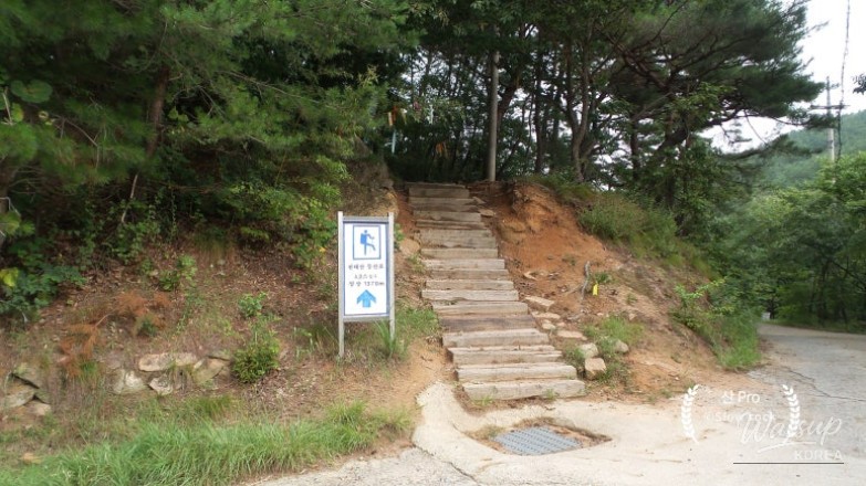
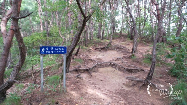
The typical round-trip course covers about 7.2km and takes approximately 4 hours. Starting from the parking lot, the route takes you through the valley, past Samsin Halmae Rock, and up the challenging Course A. This path is famous for its slab sections and steep rocky ridges that lead directly to the 714.7m summit.
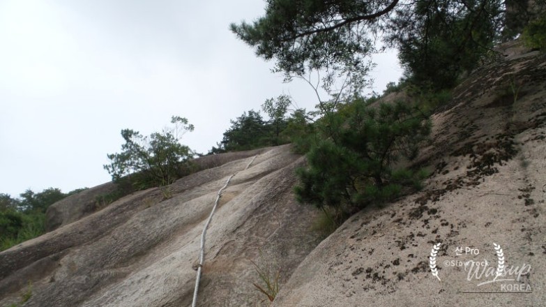
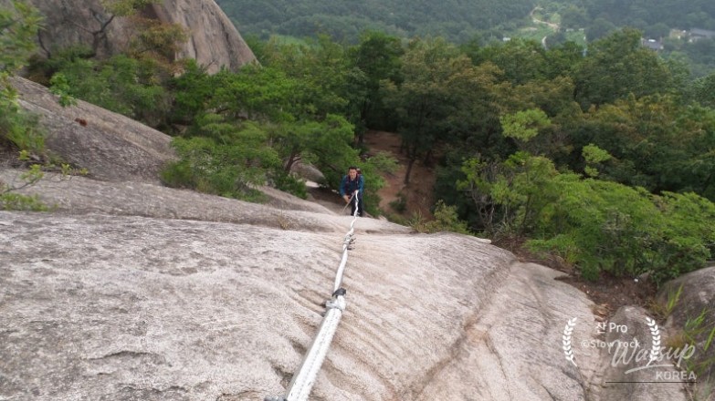
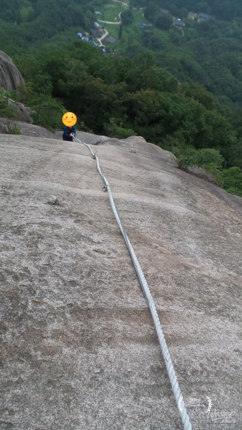
The Thrill of the 75m Rope Section
For thrill-seekers, the 75m steep slab is the definitive experience of Cheontaesan. This vertiginous rock face requires the use of thick ropes to navigate the incline. While a detour is available for those who prefer a safer route, climbing the rope section provides an unmatched adrenaline rush and a sense of accomplishment.
The granite surface offers good grip, but the sheer length of the rope section requires arm strength and focus. As you pull yourself up, the surrounding views of the valley begin to open up, revealing the rugged beauty of the Chungbuk region's landscape. It is this specific section that earns the mountain its reputation for rugged climbing.

Summit Views and Descent via Course D
Upon reaching the summit, hikers are rewarded with a panoramic view of Seodaesan Mountain to the west and the distant peaks of Deogyusan to the south. The descent via Course D offers a more relaxed ridge walk, passing through scenic spots like Shark Rock and the Mangtapbong Three-Story Stone Pagoda before returning to the valley.
Reflecting on the Seoraksan of Chungbuk
Cheontaesan Mountain may not be the tallest in Korea, but its character is immense. The combination of historical depth at Yeongguksa Temple—associated with King Gongmin’s refuge—and the physical challenge of the rocky ridges makes it a standout destination. Finishing the hike with local grapes or a bowl of Dongdongju near the parking lot is the perfect end to a day of exploration.
Traversing the steep ropes of Cheontaesan is a true test of spirit. Have you ever climbed a mountain that required using ropes or navigating vertical slabs? If you're planning a trip to Yeongdong, would you take the thrilling 75m rope challenge or opt for the scenic detour? Let us know your favorite rocky hikes in Korea!


No comments yet.