Namsan Dulle Trail Hike: A Journey Along the Namsan Ridge (Gyemyeong Branch)

Namsan Dulle Trail...
August 10, 2025 (Sun) Namsan Ridge (Gyemyeong Branch)
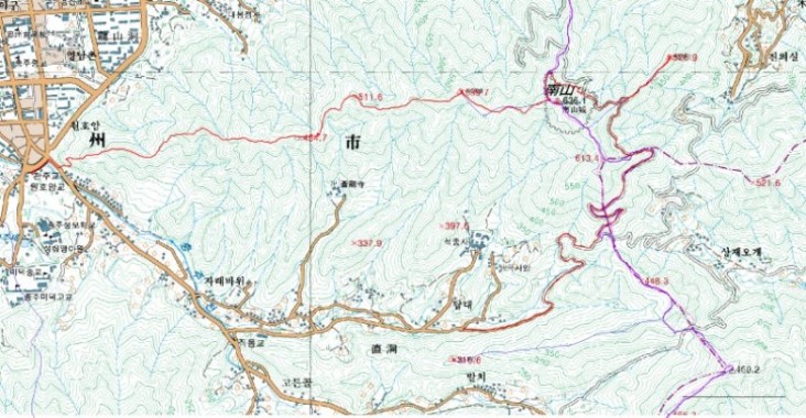
OnMap 25K: 77 Chungju
Weather: Clear, Cool Breeze
Participants: 得埽, William, 古來
GPS Distance: 8.796km
Hiking Time: 4 hours 07 minutes
Course: Seokjongsa Intersection - Namsan Forest Road - Baramgolsan Intersection - Baramgolsan (x525.9) - Namsan Fortress - Namsan Peak (636.1m) - Taebong (x599.7) - x511.6 - x454.7 - Namsan Sambong - Namsan Ibong - Namsan Ilbong - Beombawee Five-way Intersection - Dadamtteul Korean Buffet
Data from MapSend and GPS TrackMaker
Seokjongsa Intersection: 206m, 0.000km, 10:03 AM
Baramgolsan Intersection: 544m, 3.351km, 11:11 AM
Baramgolsan (x525.9): 517m, 3.716km, 11:27 AM
Namsan Peak (636.1m): 623m, 4.955km, 12:16 PM
Taebong (x599.7): 591m, 5.605km, 12:48 PM
Beombawee Five-way Intersection
Dadamtteul Korean Buffet: 110m, 8.796km, 2:20 PM
10:03 AM: At Seokjongsa Intersection, take the Namsan Forest Road on the right. There are signposts every 500m (Namsan Forest Road - Mujeokjae x km, Seokjongsa x km).
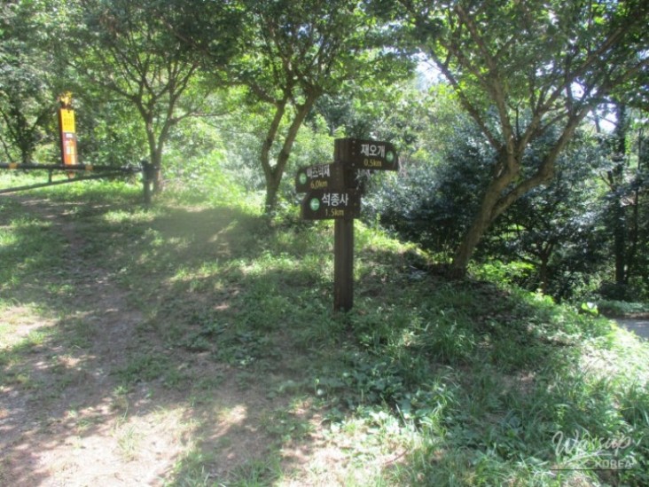
11:04 AM: Gyemyeong Branch/Jaeogae Intersection (Mujeokjae 6.0km, Seokjongsa 1.5km, Jaeogae 0.5km)
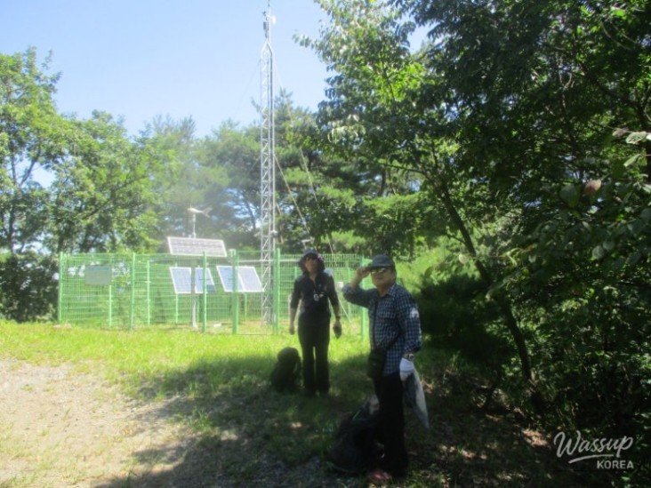
11:11 AM: Baramgolsan Intersection - Head to Baramgolsan. There is a faint path to the right through the thicket.
11:27 AM: Baramgolsan (x525.9)
11:41 AM: Return to Namsan Forest Road and head right.
11:47 AM: Rest on a bench to hydrate. Depart at 11:54 AM towards Namsan Fortress, leaving the forest road.
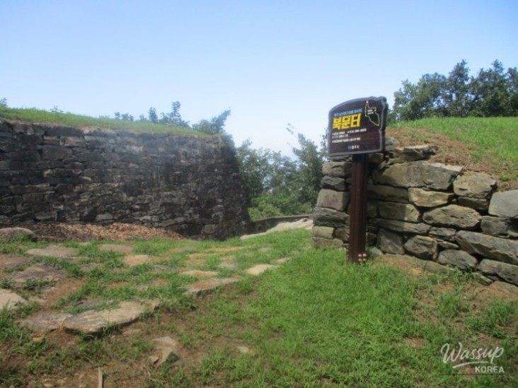
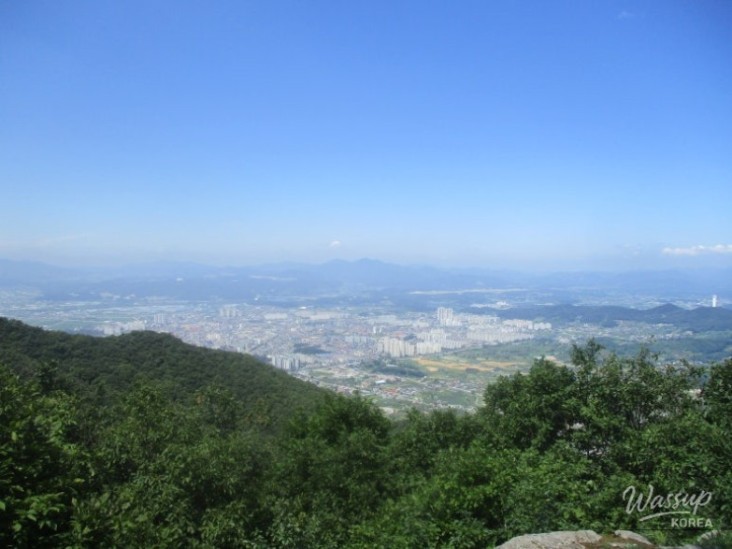
11:59 AM: Namsan Fortress East Gate (North Gate 200m, South Gate 300m). Both directions lead to Namsan. Which way to go? Start along the fortress stones towards the closer North Gate, enjoying views of Chungju Lake/Yeongbong Peak.
12:10 PM: North Gate
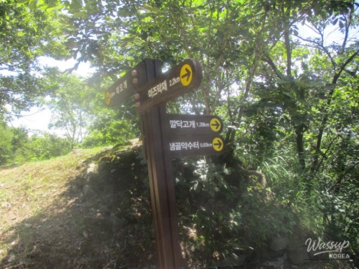
12:16 PM: West Gate (Kkalttak Hill 1.28km, Mujeokjae 2.2km, Jaeogae 0.8km). Turn left.
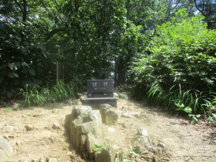
12:16 PM: Namsan Peak (636.1m) - Landmark (Namsan 636m). Turn towards Kkalttak Hill to start the Namsan Ridge trail.
12:20 PM: Take a break on the windy ridge. Depart at 12:34 PM. Stick to the path, ignoring the ridge.
12:48 PM: Taebong (x599.7)
1:03 PM: x511.6 (Scenic Viewpoint)
1:00 PM: Changnyongsa Intersection (Kkalttak Hill 0.4km, Peak 1.1km, Changnyongsa 0.4km)
1:11 PM: Kkalttak Hill, Rest Area, Signpost (Beombawee 1.87km, Peak 1.7km, Trail Entrance 0.7km). Go straight towards Beombawee.
1:17 PM: x454.7 – The Namsan Sambong, Namsan Ibong, and Namsan Ilbong shown on Kakao Map are not visible.
2:08 PM: Changing clothes after going down the wooden stairs and restarting at 2:15
2:17 PM: Beombawee Five-way Intersection (Jikdonggil), Beombawee Sign, Namsan Hiking Map. Turn left.
2:20 PM: Dadamtteul Korean Buffet
Namsan Ridge (Gyemyeong Branch) OnMap background
Seokjongsa - Baramgolsan - Namsan - Taebong - Beombawee: 4 hours 07 minutes (8.796km)
8:22 AM: Depart from Pangyo Station by train to Chungju at 9:27 AM. Take a taxi to Seokjongsa Intersection (658 Jikdong, Chungju, Chungbuk).
A cool breeze blows at the entrance of Seokjongsa.
The Namsan Forest Road has signposts every 500m (Namsan Forest Road - Mujeokjae x km, Seokjongsa x km). The road is mostly shaded by trees, with a cool breeze making it very pleasant.
From Seokjongsa Intersection, head right onto Namsan Forest Road. At the Gyemyeong Branch/Jaeogae Intersection (Mujeokjae 6.0km, Seokjongsa 1.5km, Jaeogae 0.5km), head towards Mujeokjae and ascend to the Baramgolsan Intersection.
(Heading to Baramgolsan)
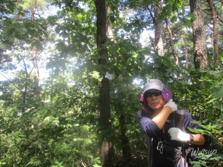
There is a faint path to the right through the thicket, leading to Baramgolsan (x525.9).
Gyemyeong Branch Jaeogae Intersection
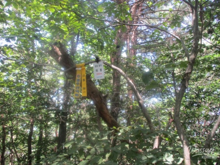
Baramgolsan Intersection
Baramgolsan
Returning to Namsan Forest Road, head right and rest on a bench to hydrate.
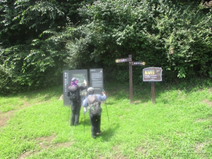
Leave the forest road and ascend to Namsan Fortress East Gate (North Gate 200m, South Gate 300m).
(Which way to go?)
Both directions lead to Namsan. Which way to go?
Start along the fortress stones towards the closer North Gate.
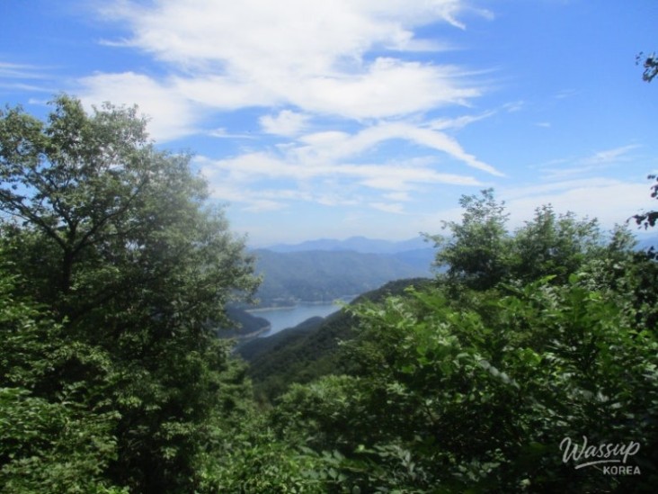
After enjoying the views of Chungju Lake/Yeongbong Peak and passing the North Gate, you reach the West Gate (Kkalttak Hill 1.28km, Mujeokjae 2.2km, Jaeogae 0.8km).
Immediately to the left is Namsan Peak (636.1m) with a landmark (Namsan 636m).
East Gate
Chungju Lake
Yeongbong Peak
North Gate
Chungju City
West Gate
Namsan
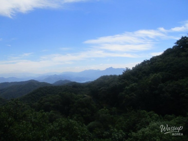
(Beginning of Namsan Ridge)
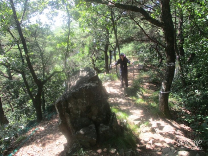
Start the Namsan Ridge walk towards Kkalttak Hill.
Take a break and eat on the windy ridge.
Stick to the path, ignoring the ridge.
Pass Taebong (x599.7) and x511.6, a scenic viewpoint.
After passing the Changnyongsa Intersection (Kkalttak Hill 0.4km, Peak 1.1km, Changnyongsa 0.4km), you reach Kkalttak Hill with a rest area and a signpost (Beombawee 1.87km, Peak 1.7km, Trail Entrance 0.7km).
Go straight towards Beombawee, pass x454.7. The Namsan Sambong, Namsan Ibong, and Namsan Ilbong shown on Kakao Map are not visible.
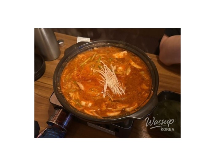
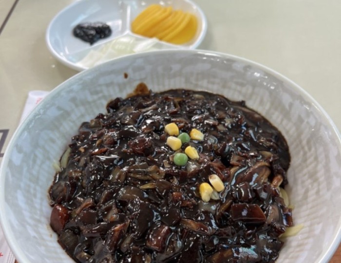
After going down the wooden stairs where you can see the road, and changing into fresh clothes due to sweating, you reach the Beombawee Five-way Intersection (Jikdonggil) with the Beombawee sign and the Namsan hiking map. Turn left and cool off at Dadamtteul Korean Buffet.
Taebong
Rock
Transportation
Going
08:22 Pangyo Station - 09:27 Chungju by train: 51,600 KRW (12,300 KRW * 3)
Chungju Station - Seokjongsa Intersection (658 Jikdong, Chungju, Chungbuk): 10,000 KRW
Returning
Dadamtteul Korean Buffet - Chungju Terminal (by Kakao Taxi): 8,500 KRW
Chungju Terminal - Dong Seoul Express Bus (Sunday): 27,000 KRW (9,000 KRW * 3)
Meals
Breakfast (CU at Pangyo Station): 4,000 KRW
Dinner (Chungju Terminal): Bean Sprout Soup - 49,000 KRW (Acorn Jelly Rice - 11,000 KRW * 3 + Soju - 4,000 KRW * 4)
Snacks: 5,000 KRW
Expenses: 49,000 KRW per person
No comments yet.